
Basic state map
The basic state map is a large-scale topographic map that is used for the purposes of: spatial planning, conceptual planning and design of infrastructure facilities, keeping statistics, creating information systems, etc.
It was prepared for the territory of the Republic of Serbia in the period of 1948-2002, 5,848 analogue sheets of basic state maps at a scale of 1:5,000 out of a total of 13,943 were produced, which is approximately 42 %. Figure 1 shows the record of prepared BSM sheets in analogue form, one sheet of which is shown as an example in Figure 2.
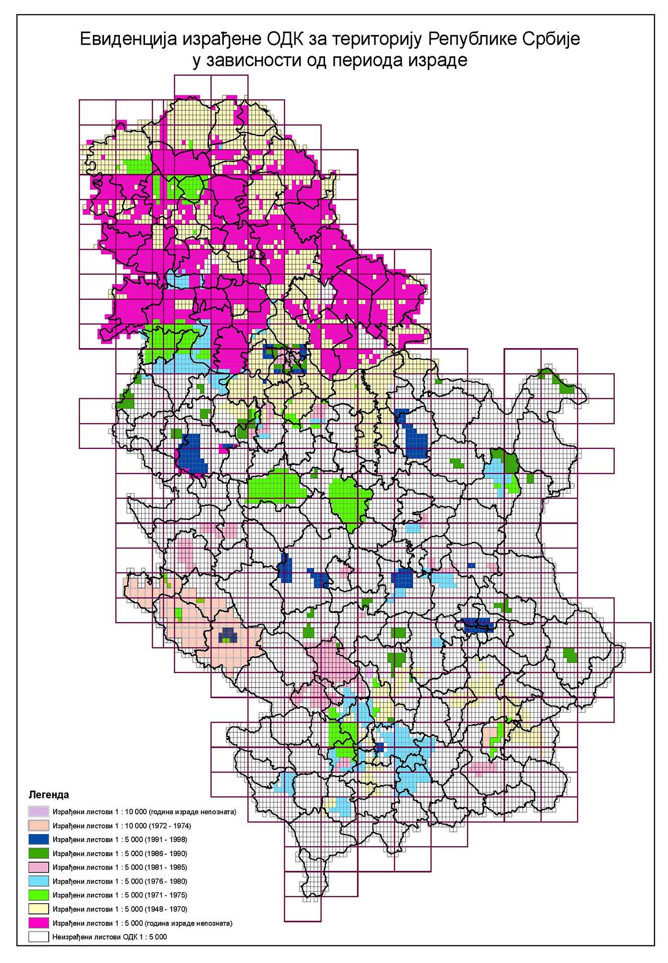
Figure 1. (Record of BSM produced for the territory of the Republic of Serbia per production period)
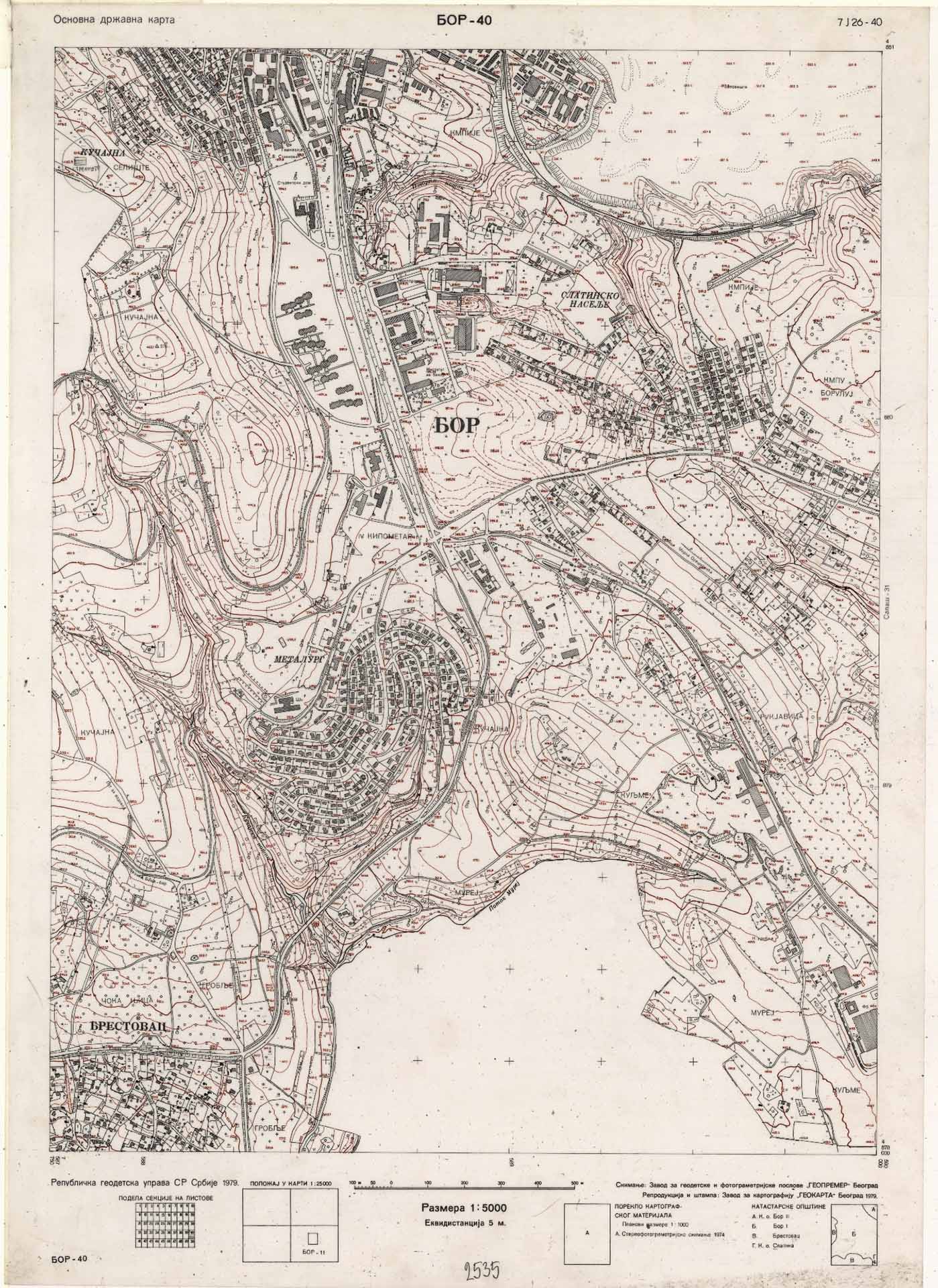
Figure 2
The Republic Geodetic Authority (hereinafter: the RGA) had produced 73 new sheets of basic state map at a scale of 1:5,000. An example of the BSM sheet in digital form is shown in Figure 3
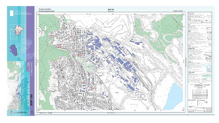
Figure 3
The basic topographical model is a database of spatial data, collected in vector form and includes the following themes determined in accordance with the INSPIRE Directive: constructions, transportation network, hydrography, land cover, relief and utilities. Based on these data, digital terrain model (DTM) and data from other sub-systems of the geodetic-cadastral information system (GCIS) for the thematic units geodetic basis, protected areas, State Border Register, Register of Administrative Units and Register of Geographical Names, the Basic State Map is created in UTM projection, in accordance with the Map key.
These data represent the basis for the application of open data principles in all developed countries and are part of the establishment and continuous improvement of the NSDI.
As part of the donor project of the Government of Japan, the project "Capacity building for the creation of a digital basic state map in the Republic of Serbia" was implemented in the RGA. Over the duration of the project from 2009 to 2012, hardware and software were procured and a technical training program was carried out, during which the RGA's officials were trained to create a basic state map in accordance with user needs and modern technologies.
The new basic state map at a scale of 1 : 5,000 was created in digital form for the area of Jagodina (8 sheets), Bor (32 sheets) and Palić (33 sheets), Figure 4.
The basic state map at a scale of 1 : 5,000 can be viewed and purchased in the Archive Department
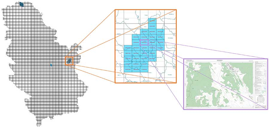
Figure 4


