

Topographic maps
Topographic maps are produced on the basis of a topographic survey and contain a large amount of information. They are used in various natural, social and technical activities, in the economy, planning, design, urbanism, transportation, hydrology, meteorology, climatology, as a topographic basis for discovering, researching and locating other thematic phenomena and conditions in space.
The Republic Geodetic Authority (hereinafter: the RGA) according to the Law on State Survey and Cadastre and the Rulebook on Topographic Survey and Topographic-Cartographic Products ("Official Gazette RS", number 7/15) based on the data of the Basic Topographic Model (hereinafter: BTM) produces topographic maps at scales of 1 : 20,000, 1 : 50,000, 1 : 100,000 and 1 : 250,000. An example of a sheet of Topographic map at a scale of 1 : 20,000 in digital form is shown in Figure 1.
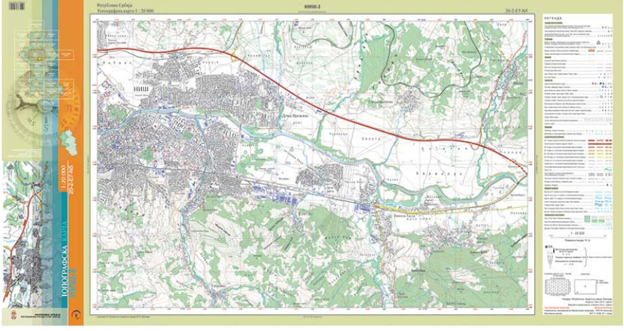
Figure 1
The basic topographical model is a database of spatial data, collected in vector form and includes the following themes determined in accordance with the INSPIRE Directive: constructions, transportation network, hydrography, land cover, relief and utilities. On the basis of these data, the digital terrain model (DTM) and data from other subsystems of the geodetic-cadastral information system (GCIS): geodetic bases, the Register of administrative units and the Register of geographical names as data on protected areas and the State Border Register, topographic maps are created in UTM projection, in accordance with the Cartographic Key. These data represent the basis for the application of open data principles in all developed countries and are part of the establishment and continuous improvement of the NSDI.
In cooperation with the French consortium "IGN France International" and "EADS Astrium" in the period from 2010 to 2013, the Republic Geodetic Authority implemented the IGIS (Integrated GeoInformation Solution) program through the project "National Spatial Data Infrastructure and Center for Remote Sensing for the Republic Serbia". The goal of the program was to improve and strengthen national capacities for the collection and application of geoinformation. As part of the IGIS program, a training program was implemented for the collection of 3D vector topographic data, which are structured into a topographic base on the basis of which topographic maps are created.
Topographic maps at a scale of 1 : 20,000 are produced for the entire territory of the Republic of Serbia. By the end of April 2023, a total of 154 sheets of topographic maps at a scale of 1 : 20,000 for the area of southeastern Serbia and Belgrade, or approximately 16.5 % of all sheets covering the territory of the Republic of Serbia, had been prepared. Field recognition and verification was done for 54 sheets. The area with the topographic map at a scale of 1 : 20,000 is shown in Figure 2.
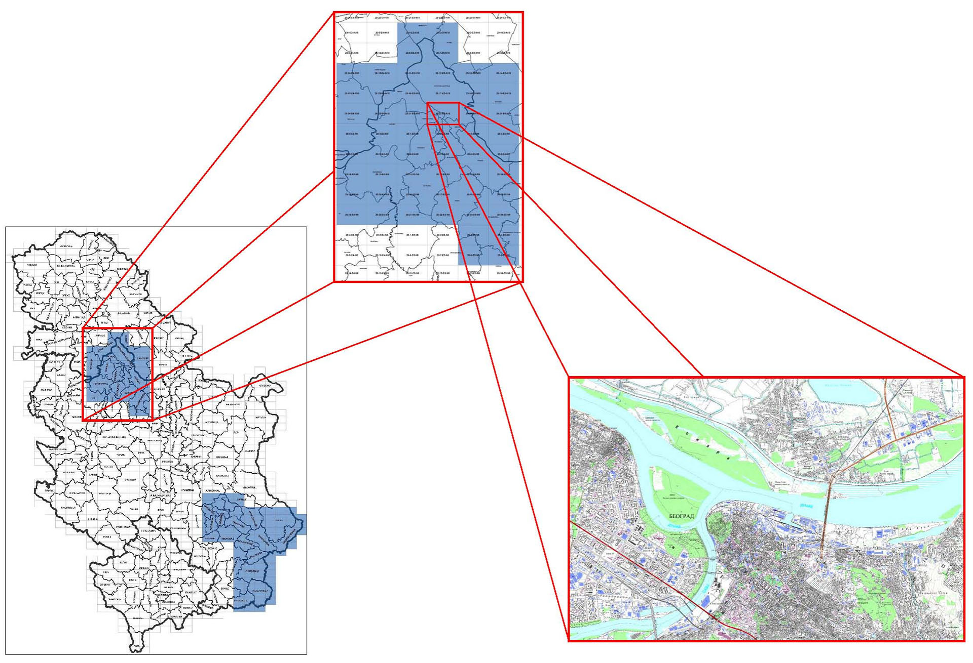
Figure 2
A topographic map at a scale of 1 : 250,000 was created for the territory of the Republic of Serbia. The topographic map at a scale of 1 : 250,000 is used as one of the basic maps on the geoportal
An example of a Topographic Map sheet at a scale of 1 : 250,000 is shown in Figure 3.
Слика 3
Files for download take from the existing website
Rulebook on topographic survey and topographic-cartographic products


