

EuroGeographics
EuroGeographics is the association of the European national agencies competent for mapping, cadastre and land registration. The association was founded in 2001. Presently, the association has 60 members from 46 European countries.
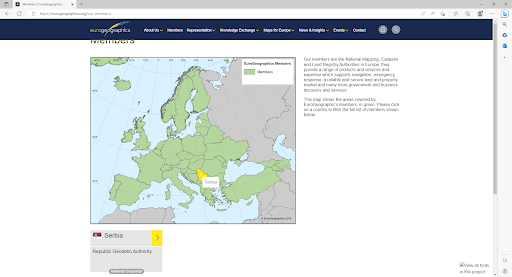
European member countries of EuroGeographics
The EuroGeographics mission is further development of the European Spatial Data Infrastructure (ESDI) through cooperation in the field of geoinformation, including topographic data, cadastre and land registration.
The objectives of the organization are:
- Assure unified voice of the European National Mapping and Cadastral Agencies (NMCA);
- Develop the network of dedicated and motivated members and promote cooperation and exchange of experience;
- Promote national and pan-European products and services and their role in the provision of reference data for the European Spatial Data Infrastructure;
- Create, maintain and distribute harmonized small-scale and large-scale reference topographic datasets as the support to the cross-border cooperation;
- Promote EuroGeographics as the European leader for the provision of geoinformation;
- Participate in creating national and European legislation pertaining to geoinformation;
- Support European mission in the implementation of programs and directives.
EuroGeographics fully supports principles of cooperation within the geospatial community. Common work is focused on the practical development and creation of visible results in the SDI establishment on national and European levels. Special attention is focused on the INSPIRE Directive implementation through creation of frameworks that will link the national infrastructures, in order to avoid duplication in data production, unnecessary costs and unavailability of data to the users.
EuroGeographics operates predominantly on the European level; however, it is also active in other regions and parts of the world. As the European association, EuroGeographics closely cooperates with the European Commission and European Parliament supporting the implementation of numerous European initiatives and projects such as: INSPIRE Directive, PSI (Public Sector Information) Directive, Copernicus service, Galileo satellite navigation system.
The Republic Geodetic Authority is an active member of EuroGeographics since 2004 and in that manner represents Serbia in this association. Through the provision of geodata for the territory of Serbia, the Republic Geodetic Authority contributes to the development of pan-European products.
EuroGeographics products
Under the umbrella of EuroGeographics, and within the cooperation with the National Mapping and Cadastral Agencies, the products at European level are produced, based on the official national data of the members. Having in mind the above, the national data unified within the common product at the European level represent a reference topographic database, which is used by other public institutions and private sector. Harmonized, consistent and available reference data meet the needs of cross-border cooperation and user requirements on the pan-European geoinformation market.
A great number of international organizations and European institutions, along with the users from commercial sector use the EuroGeographics products, namely: European Environmental Agency, Eurostat, European Central Bank, OneGeology Europe, ESRI Company, and many other users from public and private sectors.
EuroGeographics cooperates with the members to organize creation of datasets for the following products:
- EuroBoundaryMap – administrative and statistical units at a scale of 1 : 100,000
- EuroGlobalMap – topographic dataset at a scale of 1 : 1,000,000
- EuroRegionalMap – topographic dataset at a scale of 1 : 250,000
Products are developed pursuant to technical specifications based on the international standards such as ISO and OGS. Specifications are continuously upgraded according to the user requirements and needs, in cooperation with members and academic institutions. Apart from spatial data, each product also contains metadata that describe origin, quality and competence over the data, in accordance with the ISO standards. This facilitates creation of seamless and harmonized datasets based on the official national data provides by the members.
The Republic Geodetic authority produces and updates EuroGeographics products based on the Framework Licence Agreement (FLA).


